


STAGECOACH Voting District, Maricopa County, Arizona
About
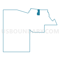
Outline

Summary
| Unique Area Identifier | 524897 |
| Name | STAGECOACH Voting District |
| County | Maricopa County |
| State | Arizona |
| Area (square miles) | 68.33 |
| Land Area (square miles) | 68.32 |
| Water Area (square miles) | 0.01 |
| % of Land Area | 99.99 |
| % of Water Area | 0.01 |
| Latitude of the Internal Point | 33.90348780 |
| Longtitude of the Internal Point | -111.82654480 |
Maps


Graphs
Select a template below for downloading or customizing gragh for STAGECOACH Voting District, Maricopa County, Arizona


Neighbors
Neighoring Voting District (by Name) Neighboring Voting District on the Map
- CANYON Voting District, Maricopa County, AZ
- Canyon Voting District, Yavapai County, AZ
- CAREFREE Voting District, Maricopa County, AZ
- CAVE CREEK Voting District, Maricopa County, AZ
- GRANITE MOUNTAIN Voting District, Maricopa County, AZ
Top 10 Neighboring County Subdivision (by Population) Neighboring County Subdivision on the Map
- Phoenix CCD, Maricopa County, AZ (2,972,357)
- Deer Valley CCD, Maricopa County, AZ (258,464)
- Tonto National Forest CCD, Maricopa County, AZ (9,713)
- Cordes Lakes-Mayer CCD, Yavapai County, AZ (6,550)
Top 10 Neighboring Place (by Population) Neighboring Place on the Map
Top 10 Neighboring Unified School District (by Population) Neighboring Unified School District on the Map
- School District Not Defined, AZ (69,809)
- Cave Creek Unified District, AZ (56,235)
- Mayer Unified District, AZ (5,679)
Top 10 Neighboring State Legislative District Lower Chamber (by Population) Neighboring State Legislative District Lower Chamber on the Map
- State House District 4, AZ (294,239)
- State House District 7, AZ (190,272)
- State House District 8, AZ (185,419)
Top 10 Neighboring State Legislative District Upper Chamber (by Population) Neighboring State Legislative District Upper Chamber on the Map
- State Senate District 4, AZ (294,239)
- State Senate District 7, AZ (190,272)
- State Senate District 8, AZ (185,419)
Top 10 Neighboring 111th Congressional District (by Population) Neighboring 111th Congressional District on the Map
- Congressional District 1, AZ (774,310)
- Congressional District 3, AZ (707,919)
- Congressional District 5, AZ (656,833)
Top 10 Neighboring Census Tract (by Population) Neighboring Census Tract on the Map
- Census Tract 15, Yavapai County, AZ (6,550)
- Census Tract 2168.29, Maricopa County, AZ (4,690)
- Census Tract 101.02, Maricopa County, AZ (4,640)
- Census Tract 304.01, Maricopa County, AZ (4,283)
- Census Tract 304.02, Maricopa County, AZ (3,895)